
Surface freshwater from rivers, lakes, reservoirs, or ponds is the primary source of water for human consumption. Water catchment areas for public supply are designated in accordance with Article 7 of the Water Framework Directive (WFD). The purpose of including these areas in the Register of Protected Areas for water bodies used as sources for human consumption is to preserve both the quality and quantity of water as a resource for this specific use. In the case of the Eastern Cantabrian River Basin District, this includes a total of 269 surface water intakes.
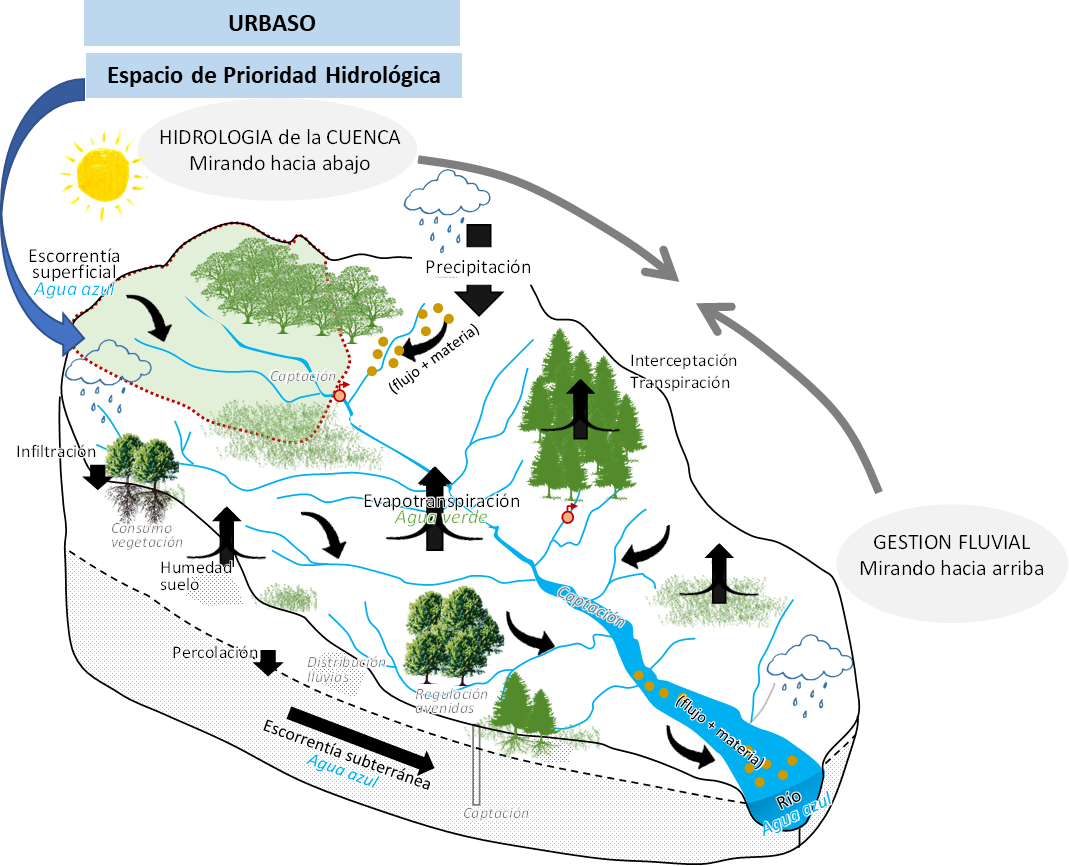
All water intakes intended for human consumption and included in the Register of Protected Areas must have a corresponding protection perimeter. This perimeter defines the areas to be safeguarded, the control measures, and the regulations regarding land use and activities to prevent negative impacts on the quantity and quality of the water at the intake points. In order to define these protection perimeters for surface water intakes, it is essential to identify and characterize the land area that drains into the intake, the CATCHMENT of the water intake for public supply. This area is considered a HYDROLOGICAL PRIORITY area in the LIFE URBASO project.
This manual outlines the procedures for delineating the catchments of water intakes for human consumption and subsequently calculating a set of catchment characteristics, including land composition, land use, and soil erosivity. It describes purpose-built tools designed to partially or fully automate these procedures using free and open-source geographic information systems.
The tools presented in this manual do not provide an exhaustive characterization of catchments but rather cover some fundamental features of interest to water resource managers. If additional catchment characteristics are required, they can be incorporated after completing the steps outlined in this manual. Both the tools and the manual aim to enhance the standardization, efficiency, and reproducibility of catchment characterization within monitoring programs. Finally, a practical example of delimitation and characterisation for the LIFE URBASO pilot catchments is presented.
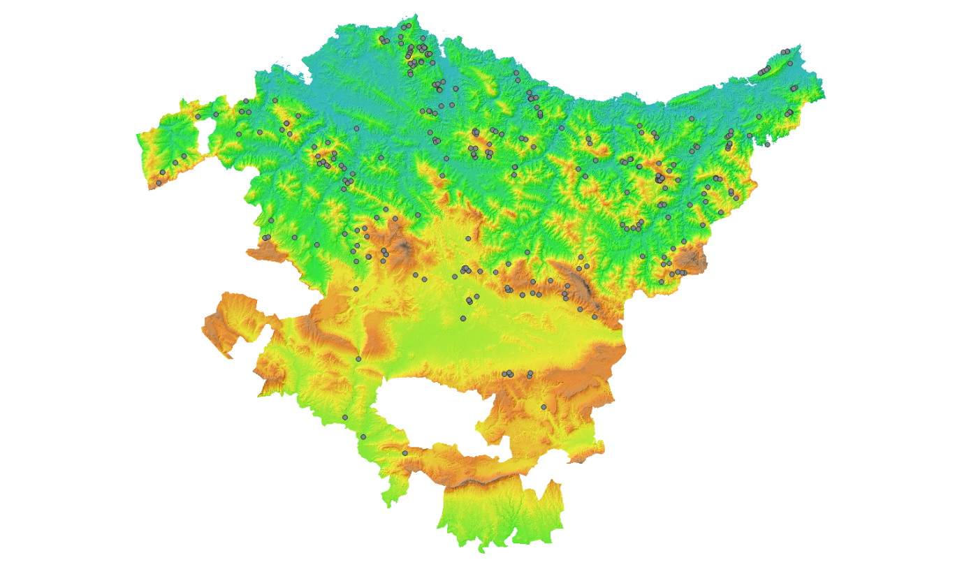
The 269 surface water abstractions intended for human consumption in the Basque Autonomous Community registered in the Register of Protected Areas of the Water Framework Directive.
See also: Manual delineación